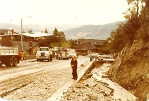
THEN » In February of 1978, rocks, mud and debris crested the filled up debris basin at the top of Pinecone Road in the Pinecrest neighborhood. Boulders clogged the flood channel going under the street, and a huge debris mass overflowed into Pinecone Road. This shot is given to us by Danette Erickson who is seen standing just to the left of the now exposed cement top of the flood channel. We’re looking south on Pinecone, near the intersection of Starfall Drive.

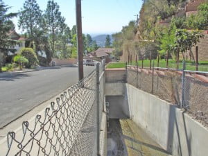
NOW » This shot is taken just a few feet north to show the current flood control channel just at the point that it goes under the street. It is quite clear how boulders and debris could have easily clogged this small opening back in ’78. The flood control system is designed so that ideally rocks and debris don’t get into these smaller channels, but get trapped in the debris basins higher up. That’s the reason why keeping the debris basins cleaned out is critical.
